This close.
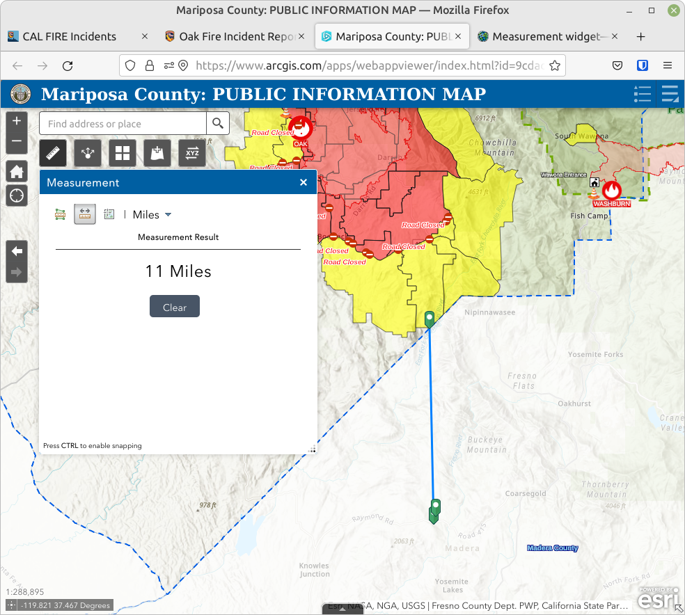
The yellow area on the map is the so-called “fire advisement” area. People in this area are not under immediate threat or warning, but are supposed to be on constant alert for changes in the fire’s status.
Because (so far) this is a Mariposa County fire only, the yellow area stops exactly at the Mariposa/Madera County line, which is 11 miles north of us. The fire, of course, is not going to stop at the county line when it gets there.
Here is a live link to the map, so you can check what things look like at the time you read this.